The Camino Companion smartphone app is out now !
I had no idea that putting together a hiking guide app for a smartphone was so much work. First, I walked the Camino Francés route last year, which took just over three weeks. The route was logged every step by GPS, and I also took over 2500 photos.
I snapped water sources, road and track junctions, accommodation options, churches, tourist information offices, restaurants, bars, you name it. This all provides a visual reference in the app so you are more likely to recognise the place when you see it. In fact there are over 1300 waypoints.

Then, Alice and Paul Bodnar of High Sierra Attitude, and Ryan Linn of Guthook Hikes have spent the last six months collating all that information to build what we think is the best smartphone app available for this route.
We looked at what was available on the market (which took some doing in itself because there really isn’t a lot of options). Then, we checked all the points they didn’t include, and put them in there with a load more features as well.
The Camino Francés route, otherwise known EL Camino de Santiago, is the most popular route to Santiago de Compostella, running east to west through northern Spain. Starting at the charming town of St Jean Pied de Port in south west France, it traverses over 500 miles to finish at Santiago. Also included is the fifty five mile extension from Santiago to Finisterre, and the eighteen mile route from Finisterre to Muxia.

The download is free and the first section, from St Jean Pied de Port to Pamplona (forty two miles) is also free so you can try it out. After that, the entire rest of the route to Santiago, and the extensions are just £7.99 / $9.99 / E4.99. There is also an option to buy the route from Sarria to Santiago (74 miles) for £3.99 / $4.99 / E4.99. This section of the trail is popular because it is the minimum distance a hiker need walk to gain the certificate of completion in Santiago Cathedral.
It is available on either Android or iPhone.

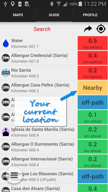
The app works in conjunction with your smartphone’s GPS to always provide a location of where you are, both on the visual map, and also the elevation graph. The elevation graph is handy, as it displays the hills coming up.
Any waypoints can be selected to provide more information. For example, click on one of the accommodation symbols, and details of that hotel / hostel etc are displayed, including contact info, website details, and the address.
The video below displays this better than I can describe it.
The Camino Companion is available now to download free. If you’re planning on hiking El Camino de Santiago, it is by far the easiest way to provide all the information you’ll need on the trail.
Forget your map and guidebook – it’s cheaper, more reliable, more accurate, and with more features. You really don’t need anything else.

